 Aguas Calientes City Guide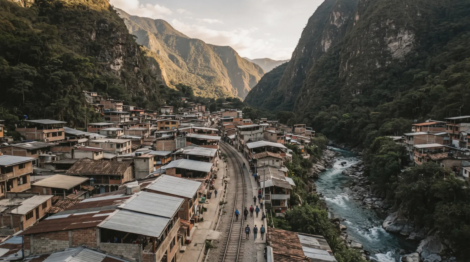
Map of Aguas Calientes: Every Pin, Distance and Gap Explained
Aguas Calientes, officially Machupicchu Pueblo, is a small town squeezed into a river valley with no road access. You arrive by train or on foot, and everything you need sits within a few blocks of the station. This Aguas Calientes map puts ten pins on one picture: the citadel gate above, the two summit mountains, the stair path from Puente Ruinas, the station, the artisan market, the plaza, the hot springs, the Mandor waterfall and Putucusi. Each pin carries a note explaining what it is and the one fact that should decide whether you go. The colour coding separates confirmed, well-documented places from those whose hours and fees no official source states.
Quick answer The short version of this map
This Aguas Calientes map places 10 pins, and the single most important distance on it is the climb from the town at about 2,040 m to the citadel gate at 2,430 m, roughly 390 m higher by our sum of the two elevations. Three things to take from this page: first, the town itself is compact, with the train station, the artisan market and the Plaza de Armas all within a short walk of each other. Second, the mountain pins Huayna Picchu and Machu Picchu Mountain have fixed entry turns with no tolerance, so their position on the map matters less than your ticket time. Third, the three brown pins, the hot springs, the Mandor waterfall and Putucusi, have no officially published hours or fees, so treat them as ask-in-town options. For a full list of what to do with your time, see things to do in Aguas Calientes, and before you rely on any gate pin, make sure you hold the right ticket from our Machu Picchu tickets guide.
Key takeaways
- The town centre sits at about 2,040 m and the citadel gate at 2,430 m, about 390 m higher, our sum.
- The train station, the market and the plaza all sit within a short walk of each other.
- The hot springs, Mandor and Putucusi pins have no published hours or fee, see things to do in Aguas Calientes for what else fills a day.
The Map: Pins Explained
Every pin below uses a verified coordinate, either from Wikidata or from OpenStreetMap. Green pins are at the ruins, dark green pins are in town, and brown pins are around town where the official record goes quiet. Read the note on each pin before you plan a detour, because for several of them the deciding fact is what is not published rather than what is. The most useful single pin is the citadel gate, since everything in town exists to get you up to it, ideally with the right ticket and a timed entry already bought. If you want the full picture of the ruins themselves, start with our Machu Picchu guide and then come back to this map to see how the town sits underneath it.
At the Ruins 4 pins
- Machu Picchu citadel gateThe Llaqta gate sits at 2,430 m above sea level. Entry is by timed ticket only, and most visitors take it with a guide, for example our entrance ticket. The Ministry's resolution for the foreign non-resident tariff was not located on a primary document, so no official foreign price is printed here. See Machu Picchu tickets.
- Huayna PicchuThe peak in the classic photos. Entry turns are 07:00-07:30 or 10:00-10:30 with no tolerance at all, so a late arrival means no entry. Details in our Huayna Picchu guide.
- Machu Picchu MountainThe longer, higher climb on the opposite side of the citadel. Entry turns are 07:00-07:30 or 09:00-09:30, again with no tolerance. See Machu Picchu Mountain before committing.
- Puente Ruinas and the stair path upThe bridge at the base of the bus road, and the start of the roughly 90-minute stair path up to the citadel described by Wikipedia. The site museum sits here too and is free between 12:00 and 16:00. Walkers can read the route in Aguas Calientes to Machu Picchu, and the bus transfer up is the alternative to the climb.
In Town 3 pins
- Aguas Calientes town centre (Plaza de Armas)The Plaza de Armas with its Pachacutec statue is the reference point for the whole town. Restaurants, the market and the bus queue all sit within a few minutes' walk, so use this pin to orient every other pin on the page. Our things to do guide works outward from here.
- Machu Picchu Pueblo train stationWhere PeruRail and Inca Rail trains arrive and depart. Both operators limit you to one carry-on piece of up to 8 kg, so pack for that limit. Times, services and booking advice in the Machu Picchu train guide.
- Mercado ArtesanalThe artisan market blocks sit directly beside the station, which makes it the easiest stop on the map between a train and a bus. Opening hours are not stated by any official municipal source. More in the market guide.
Around Town, Unconfirmed Hours 3 pins
- Banos Termales (hot springs)The pools that gave the town its name, at the top end of Avenida Pachacutec. No official hours or fee are published, so ask in town before you budget time for it. What we do know is in the hot springs guide.
- Catarata de MandorA waterfall reached by a forest walk along the river towards the Hydroelectric side. The access terms and any fee are not published on any official site, since the land appears to be privately run. Read the walk description in the Mandor waterfall guide.
- PutucusiThe steep peak on the south bank opposite the town centre. The pin is approximate because no dedicated official coordinate exists for the summit. The trail's current status is not published anywhere official, so check locally before setting out. Background in the Putucusi guide.
The Shortlist: Which Pins Are Worth Your Time First
Ten pins is more than most itineraries need. These are the ones worth a deliberate visit, with the reason each made the cut.
Start With These
-
Machu Picchu citadel gate
Shortlist pin
The destination every other pin serves. The gate sits at 2,430 m, reached by the Consettur bus road or the stair path. It made the cut because it is the only pin with a hard time attached to it. Your ticket slot, and for the mountain routes an entry turn with no tolerance, decides your whole day.
Tip: See the full map above for how this fits with everything else.
-
Machu Picchu Pueblo train station
Shortlist pin
The railhead for PeruRail and Inca Rail, with the 8 kg carry-on limit that shapes what you carry. It made the cut because nearly every visitor passes through it twice, and its position next to the market and the bus queue makes it the practical centre of the map.
Tip: See the full map above for how this fits with everything else.
-
Mercado Artesanal
Shortlist pin
The artisan market blocks beside the station, the easiest half-hour stop in town. It made the cut because it fills the gap between arriving by train and boarding the bus, needs no ticket, and sits a minute from the platform.
Tip: See the full map above for how this fits with everything else.
-
Banos Termales
Shortlist pin
The hot-water pools that named the town, a walk up Avenida Pachacutec from the plaza. It made the cut because it is the classic end-of-day recovery after the climb, though with no official hours or fee published you should confirm both in town on the day.
Tip: See the full map above for how this fits with everything else.
-
Puente Ruinas and the stair path
Shortlist pin
The bridge at the foot of the bus road, the start of the roughly 90-minute stair climb, and the site museum with free entry from 12:00 to 16:00. It made the cut because it is the walker's alternative to the bus and combines with the free museum window for anyone with an afternoon entry slot.
Tip: See the full map above for how this fits with everything else.
Numbers match the list — tap a pin for the guide.
What the Three Colours Mean
Green, dark green and brown, in that order of certainty
The map uses three colours to separate what we can document from what we cannot. The dark teal pins are at the ruins. Their hours, entry turns and rules come from Ministry of Culture resolutions and the official ticketing platform, so everything on them is fixed and checkable.
The dark green pins are in town. The station and the market are fixed physical places whose locations are verified, though note that even the market's opening hours have no official municipal source. The brown pins are the honest ones.
The hot springs, the Mandor waterfall and Putucusi all sit beyond the official record. For each of them, we searched the municipal, SERNANP and Ministry of Culture sites and found no published hours, no published fee and, for Putucusi, no published trail status either. That is why they carry a separate colour rather than a set of times.
A brown pin does not mean the place is closed. It means nobody official is telling you when it is open or what it costs, so the deciding information has to come from someone in town on the day you are there.
The Climb in Numbers
The climb in numbers
Aguas Calientes sits at about 2,040 m above sea level. The Machu Picchu citadel gate sits at 2,430 m. That is roughly 390 m higher by our sum of the two figures, and it is the number that decides whether you take the bus or walk.
The Consettur bus takes about 30 minutes per the booking card for the ride up the switchback road. Walking the stair path from Puente Ruinas takes about 90 minutes, per Wikipedia's description of the route, and it starts at the bridge pinned on the map above. Neither journey starts from zero effort, because the town is already at 2,040 m and the path climbs the full 390 m through forest and stairs.
The Distance Nobody Expects: No Road In
The distance nobody expects
There is one more distance worth naming, and it is the one that makes this map necessary in the first place. No road reaches Aguas Calientes at all. The town is connected to the rest of Peru by rail and by footpath only, which is why the station pin is the first thing you see when you arrive and the last thing you use when you leave.
Every other movement on this map, from the plaza to the hot springs to the bus queue, happens on foot within a town of a few thousand residents in a steep river valley.
The Gaps: What Is Not on This Map
The most useful line on this page
Here is the plainest thing we can tell you. The hours and fees for the hot springs, the Mandor waterfall and Putucusi are not published anywhere official. We checked the municipal, park service and culture ministry sources and found nothing, which is why those three pins are brown and carry no times.
The same gap applies to the buses. First and last bus departure times are not published by the operator either. We have the ticket-office sales window and the fare sheet the operator last self-published, but no official statement of when the first bus leaves in the morning or the last one comes down at night.
Any guide that prints those times as fact is guessing. Plan your day around your ticket slot instead, arrive early for the queue, and treat everything on the brown pins as confirm-it-in-town information. A map that admits its gaps is more useful than one that hides them.
How far is Aguas Calientes from Machu Picchu on this map?
The town centre pin sits at about 2,040 m and the citadel gate pin at 2,430 m, roughly 390 m higher by our sum. Wikipedia describes it as roughly 6 km and a 90-minute walk from the town to the entrance, or about 30 minutes on the bus road.
Why do the hot springs, Mandor waterfall and Putucusi pins have no hours?
Because no official source publishes them. We checked municipal, SERNANP and Ministry of Culture pages and found no published hours, fees or, for Putucusi, trail status. The brown colour on the map marks exactly this gap.
Where exactly is the train station on the map?
The Machu Picchu Pueblo station pin sits at -13.155850, -72.523969, right beside the artisan market blocks and a short walk from the Plaza de Armas. Both PeruRail and Inca Rail arrive and depart there.
Is the Putucusi pin exact?
No. It is marked at -13.1520, -72.5225 on the south bank opposite the town centre, but no dedicated official coordinate exists for the summit, so treat it as approximate. The trail's current status is not published either, so check locally.
Which pin has the strictest timing?
Huayna Picchu. Its entry turns are 07:00-07:30 or 10:00-10:30 with no tolerance at all, and Machu Picchu Mountain has the same no-tolerance rule for its 07:00-07:30 and 09:00-09:30 turns.
Can I drive to any of the pins on this map?
No. No road reaches Aguas Calientes at all. Arrival is by train or on foot, and within the map the only motorised leg is the Consettur bus from the town queue up the road to the citadel gate.
Walk the Town Before You Go
Three walks through Aguas Calientes, so the map above has faces and streets attached to it.
Aguas Calientes, PERU - Walking Around Aguas Calientes, The Gateway to Machu Picchu 4K Walking Tour
A continuous 4K walk through the town, the tracks and the main streets.
Video: Walking ExpeditionAguas Calientes, Peru 4K City Walk | Machupicchu Pueblo's River, Market, and Main Square
The river, the market blocks and the Plaza de Armas on foot.
Video: SIDEQUEST CAMA Tour of Aguas Calientes, Peru (the Town near Machu Picchu)
An outsider's first look at the town's layout, streets and river.
Video: Gabriel TravelerWe may earn a commission if you book through one of our links, at no extra cost to you. Full affiliate disclosure